

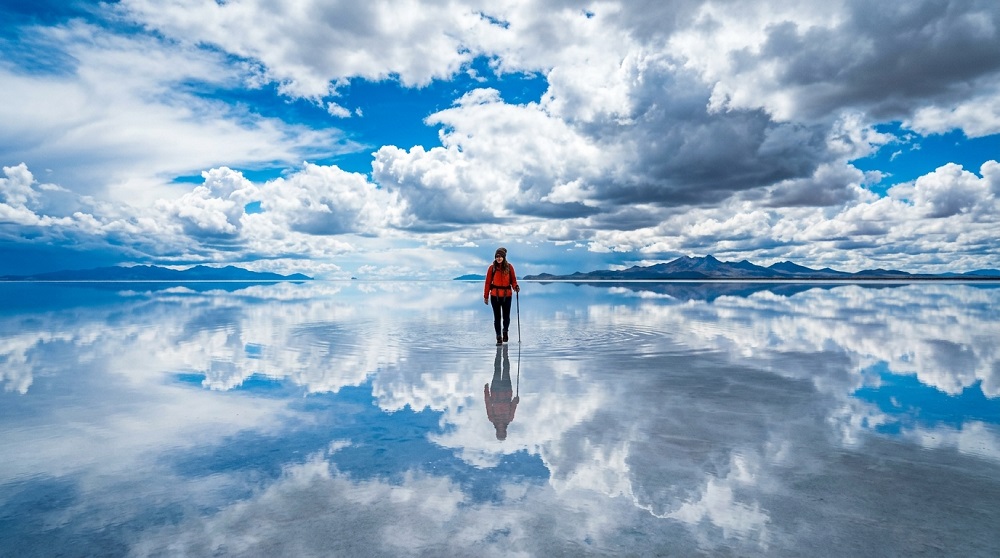
The Salar de Uyuni is about 4,000 square miles of the Bolivian Altiplano at 3,656 metres – the dried remains of a prehistoric lake. It is so level that less than a metre rises and falls over the whole area, so the satellites have instruments there to check the calibration of their instruments. Under the crust is one of the world’s biggest reserves of lithium.
Table of Contents
Choosing Your Tour
The One-Day Trip
Sails out of Uyuni town in the morning and passes through the train cemetery, Colchani, the salt hotel and Isla Incahuasi, returning for sunset. Enough to see the flat itself but it lacks all the views south.
The Three-Day Classic
The usual path, and the one you should take. On day one, it is crossed by the Salar, days two and three are spent traveling south through the Eduardo Avaroa reserve to the coloured lagoons, geysers and hot springs. Groups are typically made up of 6 people in a 4×4 and a driver-guide and cook.
Where to Start
La majority of tours originate from the town of Uyuni, either by overnight bus from La Paz or by airplane. The four day route at Tupiza is reversed (from the salt flat). San Pedro de Atacama is also an option for three-day tours which can end at the Chilean border.
What You’ll See
Before the Salt
Outside of Uyuni, the train cemetery is filled with abandoned mining-era British-built locomotives. Colchani is a village for work in salt production with a market.
On the Flat
Isla Incahuasi, which stands out of the cactus-covered crust, some more than ten metres high, centuries in age, with a small entrance fee and a walk around the island. Perspective pictures occur on the flat white surface—if that sounds like fun then bring props.
The Southern Circuit
Laguna Colorada is deep red due to algae and three species of flamingos. Sol de Mañana’s geyser field is located close to 4,850 metres, and there are mud pools and sulphur vents. Laguna Verde is under the Licancabur volcano and the Árbol de Piedra is wind carved in the Siloli desert.
During wet season or dry?
During this period of time, a shallow water layer transforms the salar into a giant mirror from December until April. The iconic picture – but if flooding does happen, some parts of the flat might be inaccessible and access to Incahuasi may be cut. May through November offers dependable roads, the cracked hexagonal crust and increased chances on the southern circuit. April and early May may provide a little of both.
Choosing an Operator Carefully
This is the most important choice. There have been serious accidents on these routes due to alcohol, speed and fatigue. Ask outright if the driver drives consecutive shifts, if the vehicle has seatbelts and oxygen, and if the price is the lowest. Rather than agency advertisements, check out recent reviews.
What to Bring
For the Cold
The nights on the southern circuit get very cold and lodging is simple, with unheated refugios and scant hot water. Own or rent a warm sleeping bag, hat, gloves and thermal clothing.
For the Sun
Glare off the salt is severe. Sunglasses, high factor sun cream and lip balm are a must and burns quicken at higher altitudes.
Cash and Gear
Bring the money in Bolivianos to pay for entrance to the park, showers and snacks (no ATMs after Uyuni). Use bags to cover camera gear between stops to prevent salt and dust from damaging the equipment.
Altitude
The circuit rises to over 4,800 metres. Acclimatise before the trip, spending 2-3 days in La Paz, Potosí or Sucre, hydrate with lots of water, and don’t overindulge in alcohol before taking off.
Three days, a reputable operator and warm clothing. The remainder takes care of itself.