

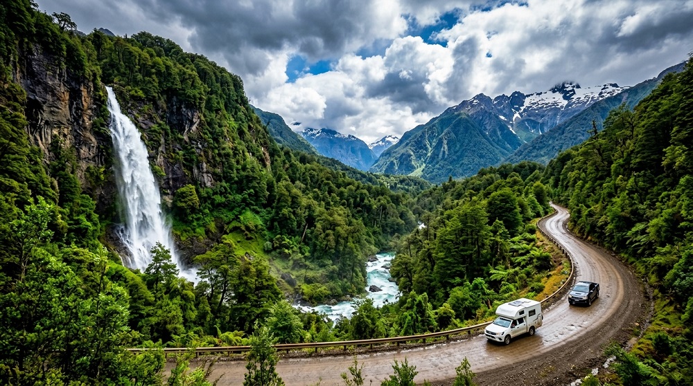
Patagonia is not a country, but a territory of about 400,000 square miles that is divided between Argentina and Chile, and the Andes act as the border. On the Argentinean part there are dry steppe and granite spires, and on the Chilean side fjords, rainforest and ice. The majority of good trips will pass through them.
Table of Contents
Argentine Patagonia
El Chaltén
The capital of trekking and even more generous: plenty of major trails leave from the village without the need for guide or transport. After a relatively steep last hour you are under Monte Fitz Roy when you reach the Laguna de los Tres. Laguna Torre is the alternative of less sturdiness.
El Calafate and Perito Moreno
A network of boardwalks looks down on a 200-foot wall that calves the glacier into Lago Argentino, like a crack at gunpoint. Both guided and surface boat approaches are available.
The town of Bariloche and the Lake District.The town of Bariloche and the Lake District.
Softer and greener in Northern Patagonia. The Glacial lakes, forest trails and the Seven Lakes Route to San Martín de los Andes. It’s also the best chocolate and craft beer in the area.
Ushuaia and Tierra del Fuego
Southmost city of the world, surrounded by the Beagle Channel. There are coastal walks and boat trips to sea lion colonies and to the Les Éclaireurs lighthouse in the Tierra del Fuego National Park. It is from here that Antarctic cruises sail.
Chilean Patagonia
Torres del Paine
The region’s hallmark national park: Three granite towers above a turquoise lake, glaciers, guanacos and harsh weather. The 5 day W trek is the popular track, and the 8 day O circuit is the less busy back side.
The Carretera Austral
About 770 miles of usually unpaved road that winds through fjords, hanging glaciers and temperate rainforest. Needs a pre-arranged rental car, and some flexibility for ferries and changes of plans due to gravel roads.
The Marble Caves
From Puerto Río Tranquilo to Lake General Carrera. Small boats come and go within the chambers of swirled marble and light blue of the water. Trips are dependent on the wind.
Chiloé
The northern entrance to Patagonia, an archipelago of wooden churches, stilt houses and a distinctive cuisine of curanto, which is cooked in the earth.
Planning Essentials
There are only so many hours in the day.The time is limited.
The best time to visit is from November to March, when the weather is mild but the nights are cold, especially from December to February when it is coldest. In April, the leaves turn autumn colours and there are fewer people. Many trails are closed for the winter season, as are many services.
Book Trekking Beds Months Ahead
Reservations for refuges and campsites on the W and O circuits fill up quickly, six months or more before the season opens. The reservation by phone and reservation online is also required for park entry. No bookings equates to no entrance.
Respect the Wind
Exposed ridges can experience sustained gusts of over 60 mph. Roups down people on the Torres approach each season. Weather changes hourly; trekking poles help.
Distances Are Deceptive
The time is about five hours by road to Puerto Natales from El Calafate, and the border crossing requires passports but will not allow fresh food. Days can be shaved from any flight path passing through El Calafate, Punta Arenas or Balmaceda.
Pack for four seasons.
Layers, appropriate waterproof shell, gloves, sun protection – the ozone layer is here and sunburns come quickly even on cold days.
Tread Carefully
The fire hazard is extreme and has burned large areas of Torres del Paine in the past. Camp stoves must be used only in specific areas, it is not allowed to have an open fire and it counts to stay on marked trails.
Allow: Wait a minimum of 90 days before removing any plants.
El Chaltén, El Calafate and Torres del Paine can be visited in 10 days. It takes two weeks to go without rushing. The Carretera Austral needs its own trip.